North Dakota was one of the states I was looking forward to traveling through, not only because I’d never been there, but it seemed to fit my theme of going to the more neglected, low population regions of our country. And fittingly so, I entered it with so little fanfare, I didn’t even know it. Moorhead, MN and Fargo, NC just seem to flow right into one another, and the Red River that divides them just seemed like an indiscernible trench.
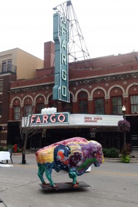 When I finally realized I was actually in Fargo, I wasn’t very impressed. The dated businesses along the highway looked like it could be the town where a used car salesman might hire people to kidnap his wife to collect a ransom. But when I found the old business street of Broadway, things looked up. The store-fronts were all in use by a mix of businesses, restaurants and bars, some of them with quite a modern chic look. And to my surprise, the street was adorned with rainbow flags as it had just finished hosting some sort of ecumenical Pride gathering. There did seem to be a progressive air to the place. Also serendipitously (for a city famous for a dark movie), I happened upon a film crew doing an ND tourism shoot – maybe El Guapo and I snuck into the background. So in the end, I left Fargo giving it props – for a place with little climate, culture or natural draws, it showed a creative energy of making the most of things.
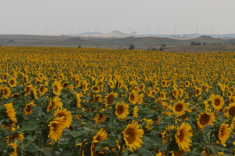
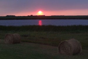 Following the sunset into the North Dakota interior, I expected to see sparseness, but I was struck at how “occupied” the sweeping landscape was. Sure the towns were small and sparse, but the agriculture industry left very little neglected. Massive fields of corn, wheat, and sunflowers blanketed the vast horizon like a precise quilt. Huge modern silo complexes looked like prairie skyscrapers. Even the grassy buffer zones that flanked Interstate 94 were used to bail hay. These weren’t family farms with barns and tractors, but the workings of a high-tech industrial complex, and I have to admit it was rather beautiful to behold. I think late August is probably the ideal time to drive across ND. Sunflower fields are blooming, crops are high, and the massive combines are combing the wheat fields.
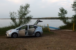
For my second night sleeping in my car, I targeted a rest area in my Rand McNally. It’s been a long time since I’ve used it, and I certainly do also rely on my iPhone map feature, but I’ve really enjoyed using the old atlas – seeing the whole sweep of a state on a page, with the parks, campgrounds, and rest areas marked; and my favorite green dotted highways to show the scenic routes. Anyway, the rest area turned out to be closed, so I took the next exit to study my options. I saw a sign to Crystal Springs Lake at that exit, and decided to check it out. I ended up finding a gravel lot boat ramp area that was completely vacant, so I parked there and slept a silent night.
After again taking advantage of my lakeside accommodations for a morning bathe, I drove into Bismarck which proved to be a contrast to Fargo in many ways. While Fargo has the University and an eclectic downtown, Bismarck has the capitol (perhaps the most dull looking government buildings I’ve ever seen) and I couldn’t find a breakfast restaurant after driving several of its central business streets. All of its commercial creativity has been left to chain stores and franchise restaurants with big parking lots just a few blocks from the old main streets. Along with an urgent bathroom need, I settled on stopping at McDonalds. I got a McMuffin combo to go, and not finding any downtown park space, I headed to the Missouri River where I fortunately found a flanking greenway and park system to help redeem the city.
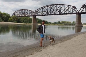 I stayed by the river a few hours catching up on some work and some writing, and learned a few lessons for myself. Standing where Lewis and Clark collaborated with local Mandan Indians, it reminded me how their epic journey was a mix of experiences. While some tribes attacked them and stole from them, others were welcoming and generous. My journey is not so risky, but the lesson is I do need to stick around a bit more to allow for engaging local people, for good or bad. Also along the banks of the Missouri, I saw my travel companion El Guapo being giddy and playful like I hadn’t seen in a while. I’ve actually been worried about him on the road as he seems to have lost his appetite, has been a little moody, and just sleeps the whole time in the car. I was reminded that he still has energy and personality, he just isn’t engaged by landscapes and scenery from the car windows. I need to make sure that we get out and he has opportunities to run around and smell things and chase things. Unfortunately, my current timing isn’t allowing much time for either of us to get out and just play.
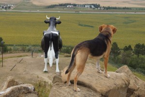 The landscape began to change west of the Missouri. The plains were still relatively flat, but began to show more ripples, ravines and buttes. Industry still blanket the surface, but there began to be more ranching mixed in with the agriculture. I also got to enjoy something that was a staple of my road trip “idea” on old highways: roadside attractions. At New Salem, El Guapo and I got to scramble around the summit adorned by Sue, the world’s largest Holstein cow.
Further West, I drove the “Enchanted Highway”, a 30 mile stretch of road that is spotted with the (self-claimed) world’s largest steel sculptures. Apparently a wealthy farmer / artist made them out of farm scrap in an effort to bring attention to small dying farm towns, like Regent, ND where the highway ends. It certainly lured me there, though I didn’t patronize the dilapidated museum, trinket shop, or castle 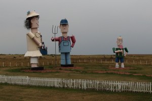 motel. I thought the attraction may have successfully lured other visitors, as I saw the out of state license plates as I went into the only bar/restaurant in town. I inquired at the table next to me where an aging couple and, I assume, grandkids sat. “Are you the ones from Oklahoma, I saw the plates outside?” They were. They were from the rural western part of the state. The old man was visibly dirty on his hands and his face. I told them, “I’m from Chelsea, OK on route 66 east of Tulsa.” The old lady asked me, “You here for the harvestin’?” Not sure what she meant, I told her I was just passing through. Then it hit me, I wasn’t talking to tourists, I was talking to domestic migrant workers. I wondered what brought more visitors to Regent: roadside attractions or an ag industry that displaced the local populace and has to seasonally replace its workforce.
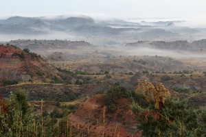 As rains came and night fell, I began my search for a good place to park and sleep. I was nearly forced into a permanent place when I got the car stuck in thick mud puddle in a frontage road turn-around. But with some maneuvering back and forth and placing some tree limbs strategically, I dislodged the Prius and continued down another exit to what ended up being a near perfect place: a national park visitor center with bathrooms and picnic shelters that also double as a 24 hour rest area AND a scenic overlook of the Painted Canyon!
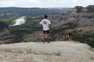 In the morning I did a short loop run on the Painted Canyon and then headed over to the official NPS entrance of Theodore Roosevelt NP. Before being president, Teddy went on a hunting trip here and eventually invested in a ranch and further developed his rugged man’s man ideal. I explored both the South and North sections of the park, mainly by vehicle on the scenic drives and was impressed with eroded layers and colors of the ravines and valleys. We saw a buffalo heard and lots of prairie dogs, both of which El Guapo had never seen and was wigging out in the car wishing he could go chase them.
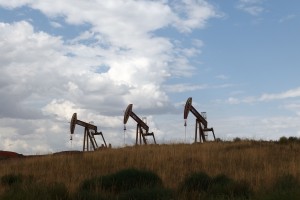 Before leaving North Dakota, I happened upon another unusual sight – Waterford Town. Along with other ND towns, it has become an oil boom town with our nation’s push toward oil independence and fracking technology. As I approached the town there were several large RV trailer parks, not for tourists but for make shift housing for the population boom. The real houses that were built in hasty communities were bland pre-fab. It had the feel of an economic refugee compound. The downtown however was an odd mix of old town buildings and extremely new buildings and restaurants that looked like they belonged in a manicured business park or suburb. Money was obviously being made and people appeared to be moving there to capitalize faster than the town can keep up.
Getting tired of the FM country and Christian radio stations, I tuned into local AM radio as my time in North Dakota came to a close. The talk shows confirmed what I had witnessed as I drove the highways across the plains: towns trying to keep up with the oil boom while trying to avoid it going bust. Farmers worried about rain and crop markets. Insecticide technology and veterinarian suggestions. North Dakota may be remote and not thought of on a national scale, but its industries keep the country running.